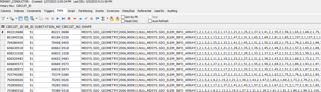
I have the following data:
I am not familiar with SDO_GEOMETRY data types, but I am trying to map these values in Google Earth.
When mapped, these values should form straight lines.
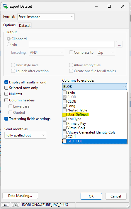
I had the idea of exporting to Excel, then saving as a CSV file and then importing that into Google Earth, but when I exported, Excel must not like the SDO_GEOMETRY data type, because it was not included. I am not sure if there is a tick box in Toad I should have selected prior to export or if Excel just simply cannot read that data type.
Does anyone know how I would go about creating a map based off my dataset?
Thank you